
Walk an Okaloosa County Street
A street search can establish the titled owner and place each parcel on the county map. It cannot establish a full household. The Property Appraiser supplies the current roll, while the Clerk's recorded instruments show title events. Voter data and old directories are dated evidence with access limits. Keep each claim tied to its source and date.
- Normalize the house number, direction, street suffix, and unit. Search the Okaloosa County property database and save the parcel ID, situs address, owner, legal description, and latest deed citation.
- Open OkaloosaGIS. Search the address or choose street-name mode, then use parcel lines and site-address layers to follow both sides of the road.
- Use the parcel card's instrument or book-and-page citation in LandmarkWeb. Read the deed before treating the index row as proof of a transfer.
- For a lawful street-level voter study, request the public extract or a narrow record from election officials. The state self-lookup is only for a voter checking their own registration.
- Ask a library branch for a period telephone or reverse directory when the question concerns an earlier household. Treat each entry as evidence for that edition, not as a current roster.
The short chain is address to parcel, parcel to owner, owner to deed, then dated residence evidence. That order prevents a mailing address or old subscriber line from being mistaken for present occupancy.
When two sources disagree, note the update date shown by each office and keep the parcel number in the search notes. That small step prevents a recent deed, an older assessment card, and a mailing-address change from being treated as one event.
Okaloosa County Street Directory Fields
The Property Appraiser's free search is the practical first index for an Okaloosa County address. Search broadly at first. A missing unit, direction, or suffix may block an exact match, and a partial owner or street string can expose the form used on the tax roll. The card is an assessment record, not a title opinion.
| Search control | Input | Required | Useful detail |
|---|---|---|---|
| Owner Name | Text | No | Try a surname, entity, or variant |
| Location Address | Text | No | Use the situs number and street; relax suffix or unit if needed |
| Parcel Number | Text | No | Best for reopening one exact property |
| Legal Information | Text | No | Subdivision, lot, or block fragment where supported |
| Search / Clear | Buttons | Not applicable | Runs or resets the query |
A result may include owner and mailing address, physical address, parcel ID, legal description, acreage, values, exemptions, sales, building facts, a sketch, and map or tax links. Homestead is strong proof that an owner claimed the parcel as a permanent home on the qualifying January 1. It does not name all people there.
- Parcel
- A mapped unit of land with its own county identifier.
- Situs address
- The assigned physical location of the taxable parcel.
- Plat
- A recorded map that defines lots, blocks, roads, and other land divisions.
- Criss-cross directory
- A dated directory arranged by street and house number instead of only by surname.
Browse Okaloosa County Streets in GIS
OkaloosaGIS adds the spatial view that a list of search results lacks. After accepting its accuracy notice, use Address, Business, or Street Search. The interface expressly directs street browsing through “Search By Street Name.” Identify opens a target parcel, while Select Parcels by Point or Box collects nearby lots. Useful layers include owner, property number, full or minimal site address, subdivision, lot and block notes, yearly sales, and road classes.
The viewer also offers aerial Sideview, measure, print, draw, bookmarks, and district layers. Map data is for reference and is not a survey. Parcel shapefiles refresh on Mondays, while nonmap CAMA assessment data refreshes nightly. A brief mismatch can reflect those update cycles, so compare the recorded deed when ownership has just changed.
The county's street atlas and map download page provides the 2026 street atlas, its index, ZIP boundaries, and municipal limits across more than 60 maps.
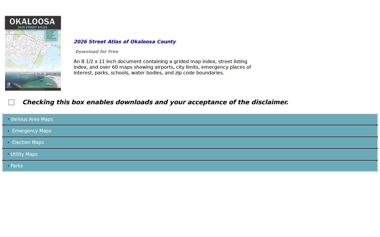
The atlas helps resolve which government serves an address before a request goes to the wrong permit or code office.
Okaloosa County Records by Address
No single Okaloosa County street directory covers ownership, occupancy, construction, and registration. The public sets below answer different questions, and each has its own keeper and fallback route.
| Address source | Official keeper | Evidence returned | Access route |
|---|---|---|---|
| Property roll | Property Appraiser | Owner, situs, mailing address, parcel, exemptions | Free portal or Shalimar/Crestview office help |
| Parcel map | County GIS | Lots along a street, site addresses, subdivisions, map layers | Free viewer, downloads, phone, or email |
| Deeds and plats | Clerk of Circuit Court and Comptroller | Title parties, legal land, dates, recording citation | LandmarkWeb, historical browser, counter, or written copy order |
| Voter file | Division of Elections and county Supervisor | Nonexempt registrants and public residence fields | Written extract request or tailored public-record request |
| Permits and code files | County or the relevant municipality | Owner, applicant, contractor, work, dates, notices | Online system, counter, phone, or chapter 119 request |
| Period directory | Library or archive holding the volume | Listed subscriber or occupant at that edition date | Catalog, digital reel, branch inquiry, or in-person reference |
The parcel ID and legal description are the strongest connectors. Street spelling can shift, and postal city names can mislead, but the property identifier ties the assessment card to deeds and many permit files.
Two Okaloosa County Address Types
The situs address locates the land. The owner's mailing address is where the tax notice goes. A coastal condo may have an out-of-area mailing address, a vacant parcel still has an owner, and an owner can receive mail somewhere other than the parcel. Never turn that mailing field into a claim about who lives at either address.
Likewise, a Fort Walton Beach, Crestview, Niceville, or Destin postal line does not prove that the parcel lies within that city. Unincorporated pockets share those mailing names. Use the parcel's jurisdiction and GIS municipal layer before choosing a building office or city clerk.
Key distinction. Mailing address is a useful lead, but only the situs field identifies the parcel being searched.
From Okaloosa County Parcel to Deed
Official records are mainly indexed by party, document type, dates, book and page, instrument number, or legal description. A modern address alone is not the best LandmarkWeb key. Start on the parcel card, copy its latest sale citation, then open the exact recorded deed. Confirm that its legal description matches the parcel before following the seller.
To go farther back, search the seller as a prior grantee. The LandmarkWeb Official Records Search handles modern indexed records. For earlier work, the Historical Index Browser presents scanned direct, meaning grantor, and indirect, meaning grantee, books from 1915 through July 1982. Banks have separate classes in some 1956–1980 volumes. Browse the alphabetical image, copy book and page, and obtain the deed image or exact pages.
The successful historical-browser capture shows how Okaloosa County exposes the old index path online.
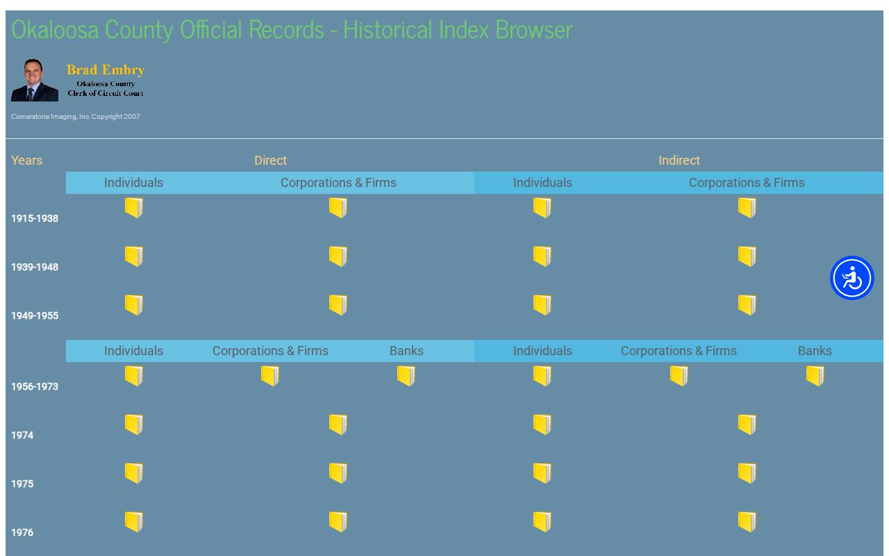
The distinction matters: indirect books show when a person acquired land, while direct books show when that person conveyed it.
Okaloosa County Street Permit Jurisdiction
Building records can date work and connect an applicant, owner, contractor, parcel, and work-site address. First identify jurisdiction. Okaloosa County Growth Management serves unincorporated land, while a parcel within one of the county's municipalities normally routes to that city's building department. The county's online permit access is split: an older search covers records through April 2025, and a newer system covers later work.
County-served parcel results in WebGIS can link to County Permit Information. If the online systems fail, contact Growth Management at 1250 N. Eglin Parkway, Suite 301, Shalimar, 850-651-7180, or inspections at 812 E. James Lee Boulevard, Crestview, 850-689-5080. Counter hours are Monday through Thursday, 8 a.m. to 4 p.m., and Friday, 8 a.m. to noon. A narrow county public-record request should state the address, parcel ID, date range, department, and desired format.
Note: Permit files date a project and its named participants; they do not prove who occupied the site when work occurred.
Okaloosa County Street Voter Evidence
Florida's public voter fields can include name, address, date of birth, party, phone, email, and participation history. Election participation never reveals ballot choices. Confidential identifiers, protected voters, Address Confidentiality Program participants, and preregistered voters are omitted where the law requires.
The Florida Voter Information Lookup is a self-service check requiring first name, last name, full birth date, and acknowledgment. It cannot browse an Okaloosa street. Street-level work instead uses the state voter extract request or a focused request to the Supervisor of Elections. Monthly files are delivered on disk by mail or scheduled pickup, not by email or instant download. This makes voter evidence a controlled supplement, not a casual household list.
Past Okaloosa County Streets by Directory
Historical address work belongs to a specific edition. The Library of Congress has digitized Crestview and Fort Walton area white and yellow pages for 1957 through May 1963. Entries give a surname, given name or initial, street or rural route, and phone number. They do not provide the richer occupation and ownership fields found in some classic city directories.
For more, search the Okaloosa County Public Library Cooperative catalog, then call the branch holding local files. Ask by place name for telephone books, reverse directories, yearbooks, newspapers, and obituary files. Exact local holdings are explained on the Okaloosa County city directory page. A rural route, changed direction, or renamed road should be bridged with a subdivision plat, parcel ID, section-township-range, and the county atlas.
Okaloosa County Street Records Before 1915
Okaloosa County was formed from parts of Santa Rosa and Walton Counties in 1915. That date is a hard boundary for the Clerk's own historical browser. An older title or family trail may continue in either predecessor county, depending on where the land lay when the event occurred.
Use the legal description rather than a later mailing line. Section, township, range, subdivision, block, and parcel references hold their value when a road name or rural route changes. State Archives tax rolls from 1915 through 1943 can add taxpayer and land-value evidence for the county's first decades, but they still do not identify every occupant.
Okaloosa County Street Directory Limits
A public address search cannot supply a full list of renters, children, guests, base residents, utility customers, or everyone who receives mail there. Motor-vehicle address data is restricted by federal law. A parcel card proves an assessment relationship, a deed proves a title event, and an old directory proves only that a listed subscriber appeared in that edition.
Some protected owners present a partial record. The parcel number, site address, map, values, and exemption amounts may remain visible while ownership, deed, exemption type, phone, or email answers are withheld. Respect that line. Do not try to defeat a statutory exemption or a survivor's substitute address.
Lawful use. Use Okaloosa County street records for family research, property history, civic study, and other lawful personal purposes. Never use an address trail to stalk, harass, threaten, or intimidate anyone.